Collecting and analysing data helps us to prepare for the challenges ahead.
On this page:
What does it mean to monitor water?
Victoria’s water resources are monitored and analysed from over 950 surface water and 1,400 groundwater sites. This is done on an ongoing basis. In many cases, this is done daily or even hourly. This process involves the measurement of key indicators of water quality. These can include:
salinity
pH (potential of hydrogen)
turbidity
dissolved oxygen.
Other recorded measurements include water level and water flow, quantity of water used, what it is used for, and how much is held in storage for future use. All measurements are assessed against a consistent set of standards.
Long-term water data and past conditions such as stream flows are essential for managing water. Data can help predict the impact of extreme weather events, too. Events such as floods, the impacts of climate change, or the onset of blackwater or other water quality emergencies.
Using the data
Data and predictions on water resources allows authorities to:
issue flood warnings and mitigate flood damage
make well-informed decisions on how much water should be allocated to different uses
estimate future water resources and needs
measure compliance against targets
determine how much water needs to be sourced from groundwater and desalination sources to meet domestic and environmental needs
decide whether and where water restrictions need to be implemented
develop management strategies to improve water quality for human uses and environmental outcomes.
Programs such as WaterWatch and Frog Census allow volunteers (known as ‘citizen scientists’) to participate in monitoring programs. Volunteers play an important role in gathering and analysing water data across Victoria.
Every day, hundreds of people collect, monitor and analyse water data from over 2000 sites across Victoria. Learn how this process works from the people who do it every day in this video from the Department of Energy, Environment and Climate Action.
Hannah Sleeth is a Data Officer from the Department of Energy, Environment and Climate Action (DEECA). In this video she discusses her unexpected path to working in water monitoring, and why data is so important and what it can help us achieve.
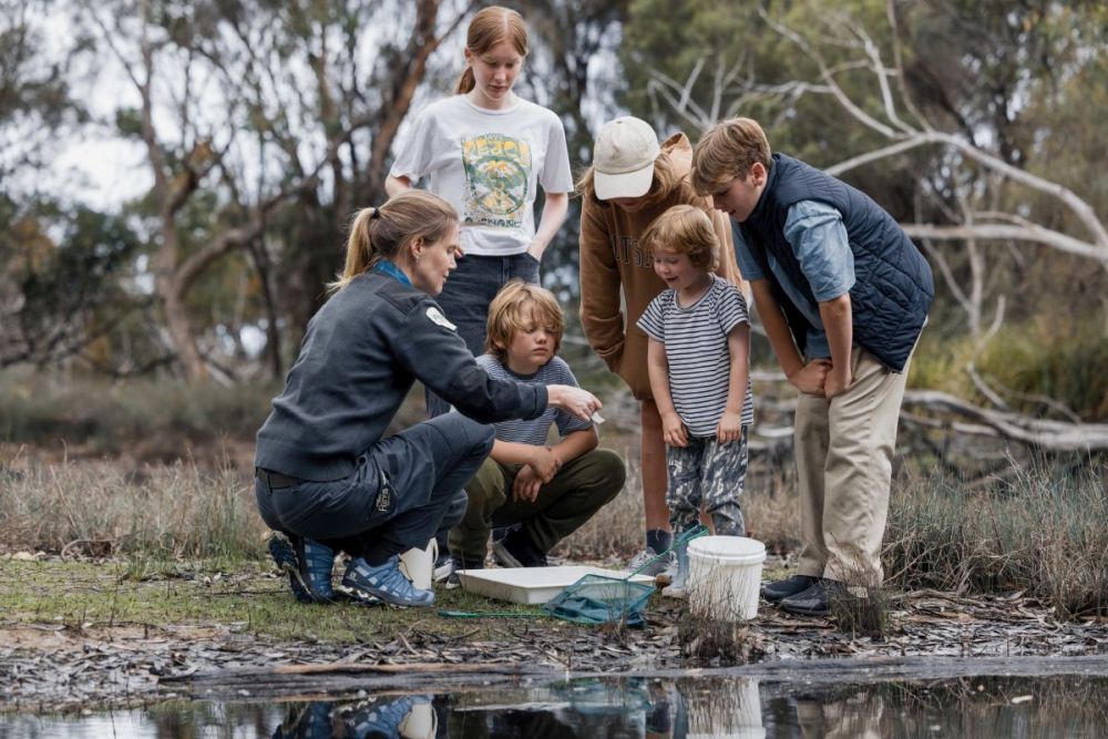
A parks officer shows some children (known as Junior Rangers or citizen scientists) water monitoring samples by a waterway in the Ocean Grove Nature Reserve.Image credit: Parks Victoria
-
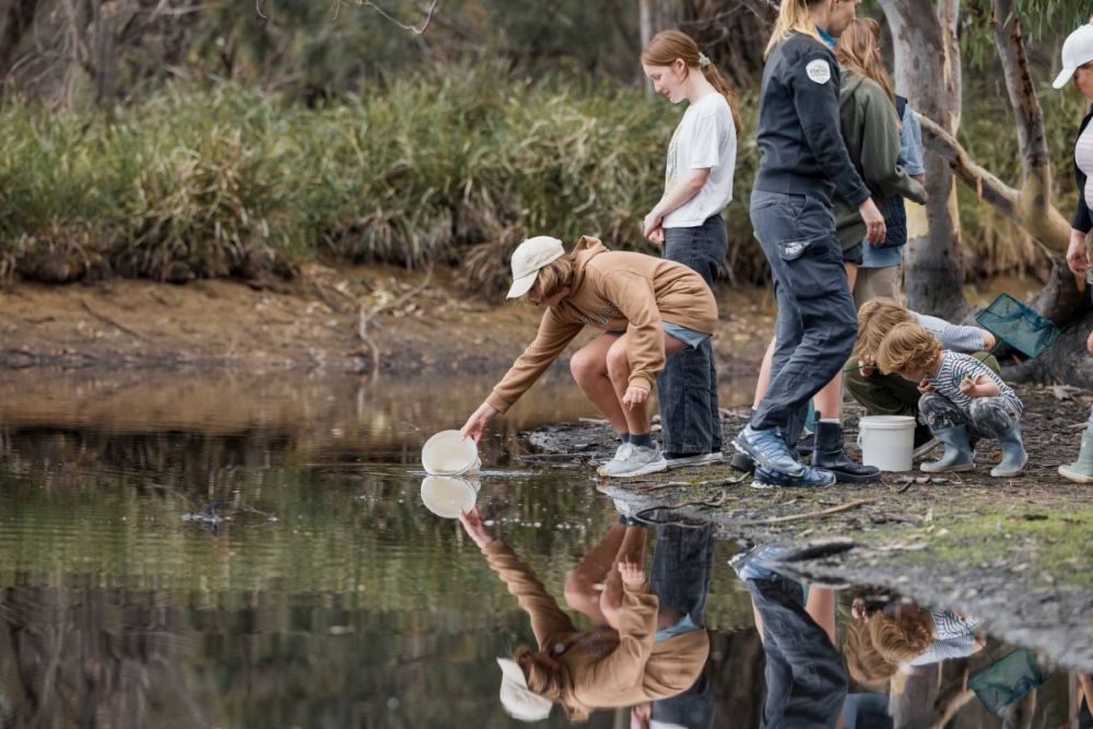
Children (known as Junior Rangers or citizen scientists) collect water samples for inspection by a waterway in the Ocean Grove Nature Reserve.Image credit: Parks Victoria
-
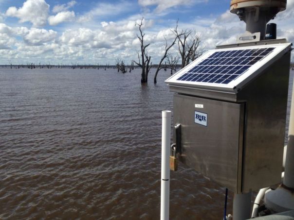
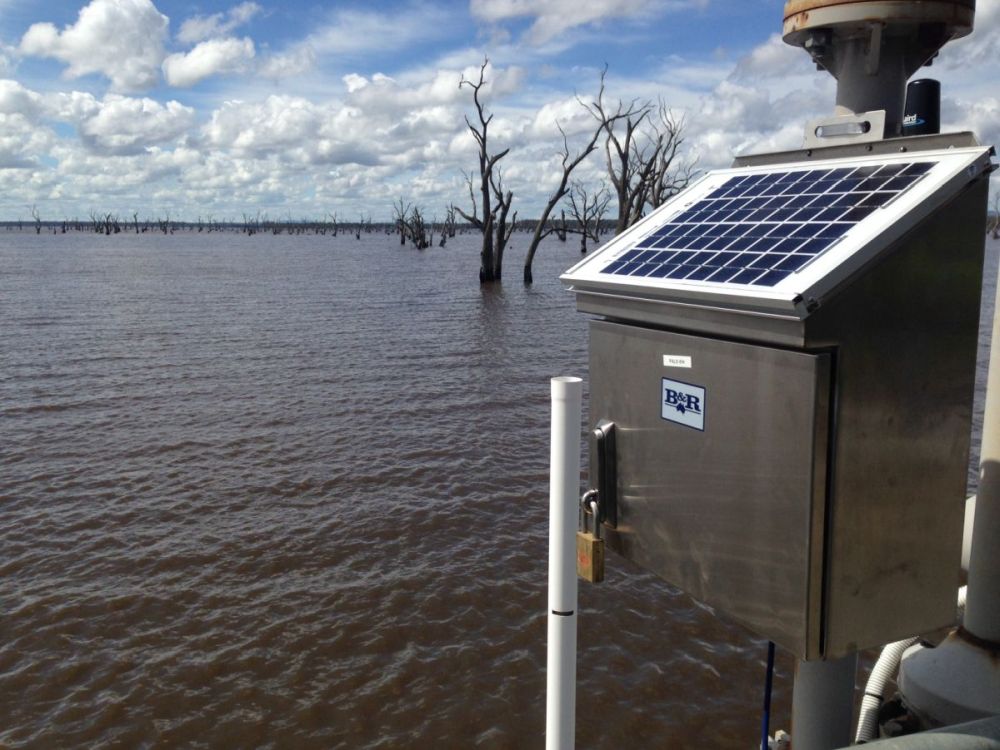
This solar-powered water monitoring collection device (known as a Portable Automated Logging System, or PALS) operates in Lake Lonsdale near Stawell in the central-west of Victoria.Image credit: DEECA
-
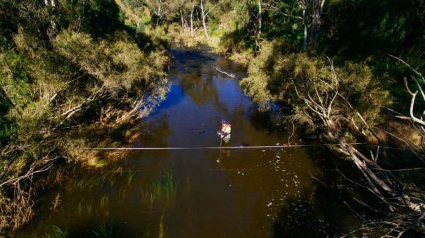
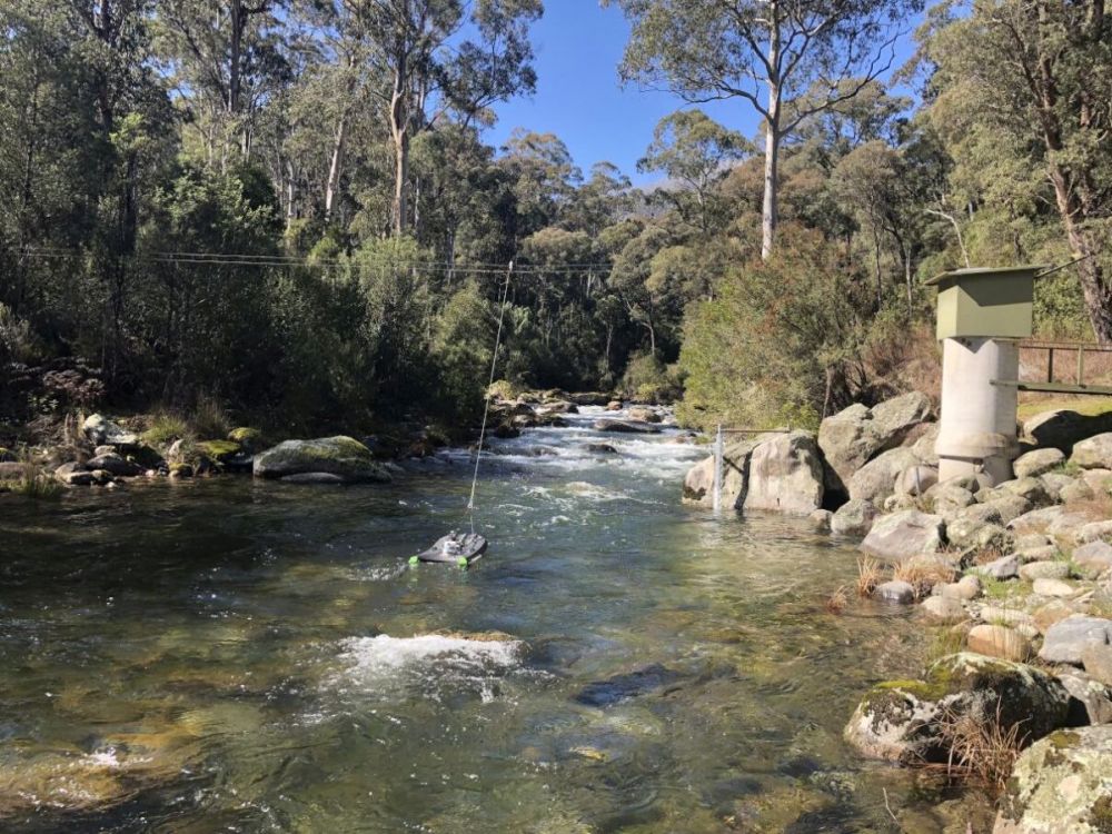
Water monitoring can be achieved by having portable devices that resemble small boats or boogie boards attached to cables.Image credit: DEECA
-
Sometimes field staff must enter a waterway to assess water monitoring activities.Image credit: DEECA
-
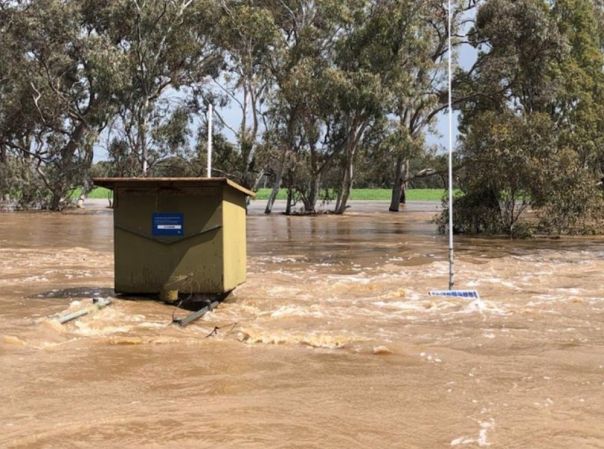
A solar-powered water monitoring collection device (known as a Portable Automated Logging System, or PALS) is almost entirely underwater from flooding.Image credit: DEECA
-
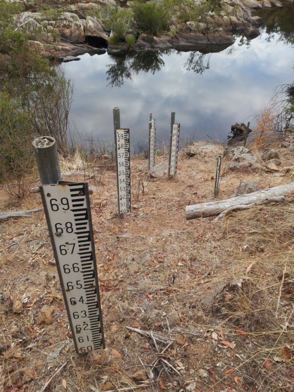
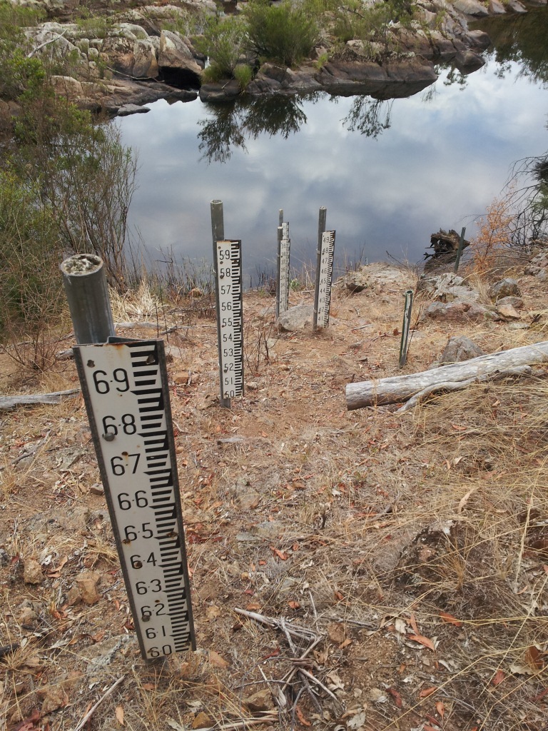
River heights can be assessed by these gauges that you will find alongside most waterways. This sort of data is important for flooding but also during times of drought and dry conditions to assess the impact on water levels.Image credit: DEECA
-
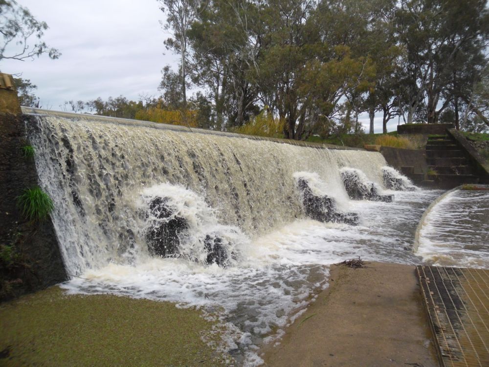
Weirs like this one, Caseys Weir on the Broken River between Shepparton and Benalla, can benefit in the accumulation of water monitoring data.Image credit: DEECA
-
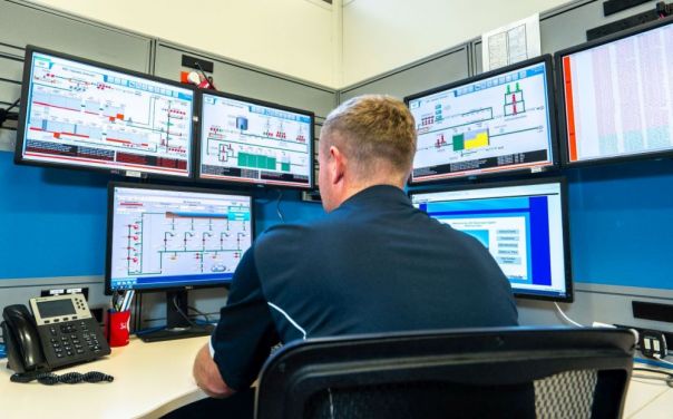
Water monitoring technology allows water corporation staff to access data on a daily or even hourly basis.Image credit: DEECA and Darryl Whitaker
-
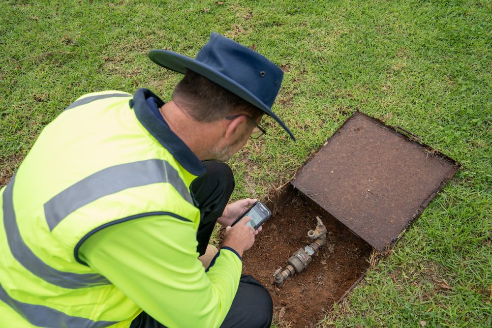
Household water meters are read by water corporation staff to monitor private water usage.Image credit: DEECA and Darryl Whitaker
A parks officer shows some children (known as Junior Rangers or citizen scientists) water monitoring samples by a waterway in the Ocean Grove Nature Reserve.
Image credit: Parks Victoria
Children (known as Junior Rangers or citizen scientists) collect water samples for inspection by a waterway in the Ocean Grove Nature Reserve.
Image credit: Parks Victoria
This solar-powered water monitoring collection device (known as a Portable Automated Logging System, or PALS) operates in Lake Lonsdale near Stawell in the central-west of Victoria.
Image credit: DEECA
Water monitoring can be achieved by having portable devices that resemble small boats or boogie boards attached to cables.
Image credit: DEECA
Sometimes field staff must enter a waterway to assess water monitoring activities.
Image credit: DEECA
A solar-powered water monitoring collection device (known as a Portable Automated Logging System, or PALS) is almost entirely underwater from flooding.
Image credit: DEECA
River heights can be assessed by these gauges that you will find alongside most waterways. This sort of data is important for flooding but also during times of drought and dry conditions to assess the impact on water levels.
Image credit: DEECA
Weirs like this one, Caseys Weir on the Broken River between Shepparton and Benalla, can benefit in the accumulation of water monitoring data.
Image credit: DEECA
Water monitoring technology allows water corporation staff to access data on a daily or even hourly basis.
Image credit: DEECA and Darryl Whitaker
Household water meters are read by water corporation staff to monitor private water usage.
Image credit: DEECA and Darryl Whitaker
Further resources
Below you can find a variety of resources to further research and understand water monitoring and data in Victoria.
Annual Water Outlook – how Victoria’s water corporations will respond to water shortages.