On this page:
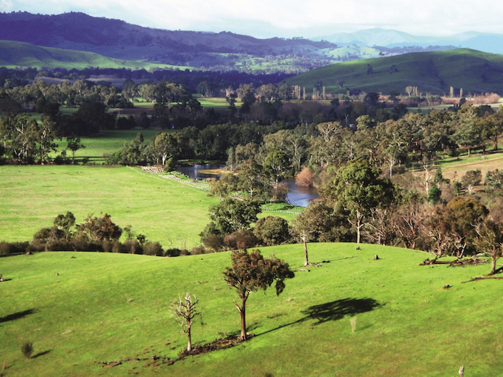
Riparian land plays a unique role in the water landscape. It provides habitat and supports diverse communities of water dependent plants and animals. It filters water, reduces erosion and supports the productivity of the surrounding area.
Riparian land has cultural and environmental values. It’s enjoyed for fishing and other recreational activities. Riparian land contributes to regional economies through agriculture and tourism.
Riparian land plays an important role
When in good condition, riparian land provides a range of important values and functions.
Climate change
Riparian vegetation can protect against some of the effects of climate change.
Extra shade helps regulate water temperature which can be important for fish and helps prevent algal blooms.
A continuous corridor of riparian vegetation along waterways provides a connection for plants and animals threatened by climate change to move to more suitable habitats. Riparian vegetation also helps mitigate climate change by soaking up (sequestering) carbon.
Living culture
Within 1 km of a waterway, 95% of listed Aboriginal places occur. These can include sites such as middens, scar trees and fish traps. These places have great spiritual and ceremonial significance.
For Traditional Owners, connections to land and waterways on their Country are inextricably linked to their cultural identity, health and community wellbeing.
Healthy habitat
Riparian land provides critical habitat for native plants and animals while supplying organic matter as a food source.
Vegetation on riparian land improves water quality by filtering nutrients and sediment. Riparian vegetation reduces soil erosion and flood damage by stabilising the riverbed and banks.
Human uses in agriculture and recreation
Riparian land can provide grazing, shelter and access to water for livestock.
Waterways are also important sites for recreation. Communities enjoy walking, picnicking, swimming and fishing on riparian land. It also creates tourism opportunities for regional areas.
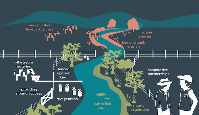
Threats to riparian land
There are several threats to the condition of riparian land and the values and functions it provides.
These include activities that degrade native vegetation, spread invasive weeds, erode river banks, make river access more difficult, contaminate the water or create litter and other issues if not well managed.
Significant threats include:
- uncontrolled stock access is the major threat to riparian land as it causes trampling on the bed and banks
- Weeds and pest animals
- unmanaged vehicle access and stream crossings
- rubbish dumping
- past clearing of native vegetation
- recreational activities
- urban development
- some agricultural practices such as cropping too close to riparian land.
Riparian land in Victoria
Victoria has a unique network of public riparian land known as Crown frontages (owned by the State), which were mostly established between the 1850s and the 1880s in recognition of their value as a public resource. Crown frontages occur mostly on larger waterways. On smaller waterways in agricultural landscapes, riparian land is usually privately owned.
Of the estimated 170,000 km of river and creek frontage in Victoria, about 30,000 kilometres are Crown frontages. The remaining riparian land is a mix of privately owned and other types of public land, for example in national parks.
At present, about 17,000 km of the 22,000 km of Crown frontages within cleared catchments are managed by the adjacent landholder, under about 9,000 agricultural licences. Most of these licences are for grazing purposes.
Licences can now also be issued or amended to recognise that all or part of the frontage is being managed to protect and improve the riparian environment, for example, fenced out and supporting native vegetation. These are called riparian management licences.
Crown frontage licences are typically issued by the Department of Environment, Energy and Climate Action (DEECA) as the primary land manager for Crown frontages. Sometimes, they are also issued by other public land managers such as:
- Parks Victoria
- Traditional Owners
- committees of management
- local government.
For more information about Crown frontages, including riparian management licences, go to the DEECA Water frontage licensing.
Managing riparian land
The government currently invests in catchment management authorities (CMAs), who work with landholders, Traditional Owners and other partners for riparian management on public and private land. CMAs and partners undertake on-ground riparian management activities in priority areas. Regional waterway strategies identify these priority areas.
This work is made possible through voluntary and cooperative partnerships set out in riparian management agreements between CMAs and landholders on both public and private land.
On Crown frontages, adjoining landholders typically also have a grazing licence (as noted in the above section), which is converted to a riparian management licence when riparian management works are undertaken. This means the riparian management works undertaken by one licensee are protected when the licence is transferred to a new licensee.
Melbourne Water invests in the same approach to riparian management in the Port Phillip and Westernport Region. Funding in these areas for riparian management is through customer rates rather than government investment.
Some of the benefits of riparian land management include:
- improved water quality with significant benefits to public health
- better stock management, stock water quality and productivity
- improved habitat and diversity of native vegetation.
Typical riparian management activities include:
- fencing keeps out livestock and revegetation
- off-stream stock watering infrastructure and controlled grazing
- weed and pest management.
Some waterways in Victoria are now almost entirely fenced and protected. For example, there is fencing on around 2,100 km of the Glenelg River and its tributaries. Several waterways in the Goulburn Broken catchment are more than 80% protected from stock.
Read more about livestock management on riparian land.
Policy and guidance for riparian land
The policy for managing Victoria's rivers, estuaries and wetlands and their riparian land is set out in the Victorian Waterway Management Strategy.
Page last updated: 22/04/25