On this page:
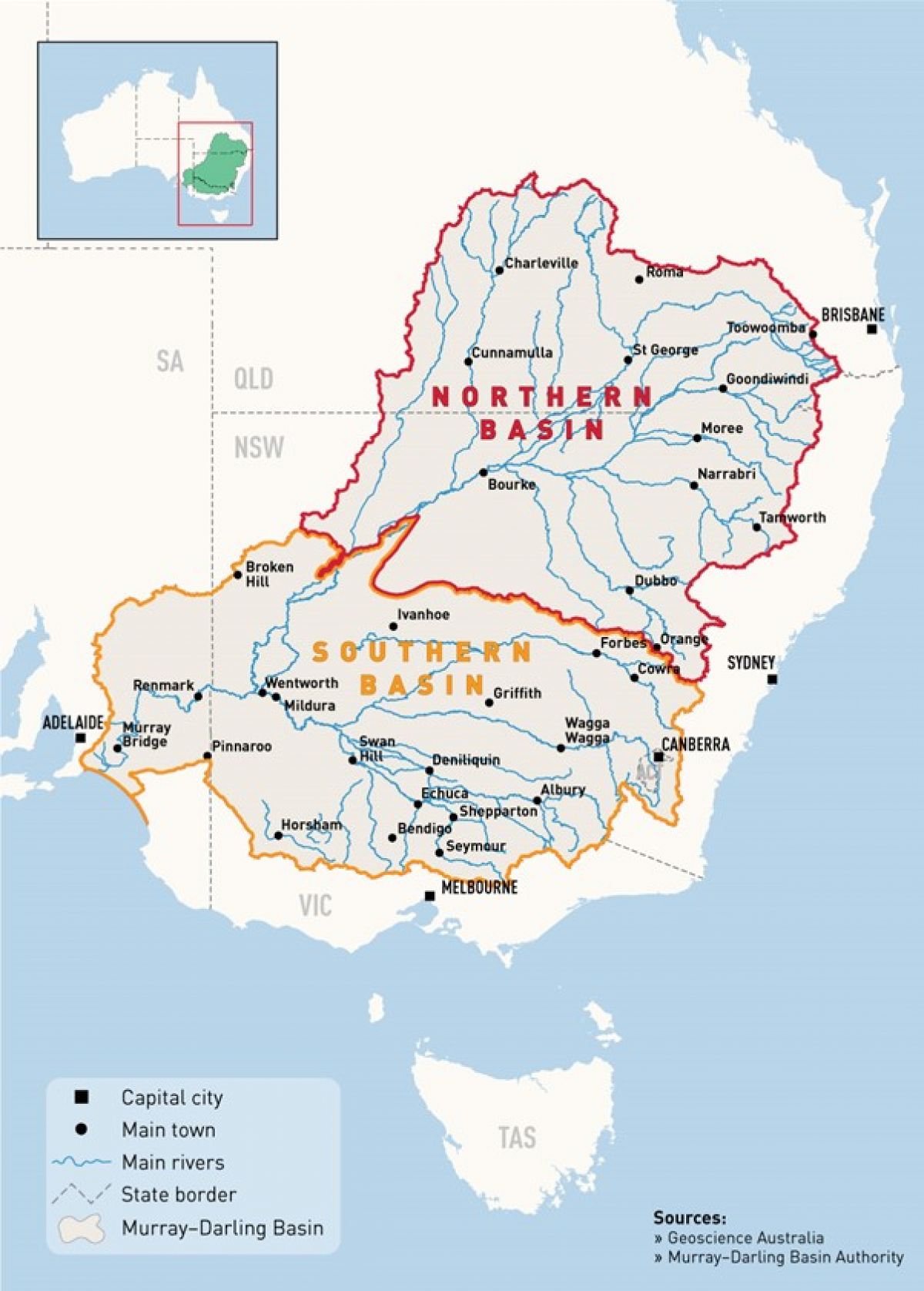
Where is the Murray-Darling Basin?
The Murray-Darling Basin is one interconnected system of rivers, the largest in Australia. It spans an area of around one million square kilometres.
The Murray-Darling Basin stretches across parts of Queensland, New South Wales, ACT, Victoria and South Australia.
Over many years of human use, the Basin showed signs of poor health. Droughts and a growing population called for better planning on both human and environmental water needs.
Managing our water and the Basin’s health
The Federal Government and state governments formed a plan that could manage our water and the Basin’s health. The Murray-Darling Basin Plan was signed into law in November 2012 under the Commonwealth Water Act 2007.
The Murray-Darling Basin Plan is a partnership that shares water between all users and the environment sustainably. It gives all water users in the Murray-Darling Basin a framework for working together toward a healthy, working Basin.
The Basin Plan sets limits on how much water can be taken from this vital system of waterways. These limits are called Sustainable Diversion Limits (SDLs), which came into effect in 2019. SDLs can limit the amount of water taken from the Murray-Darling Basin for:
- irrigation supply
- town use
- industrial uses
- drinking water supply
- any other future use.
How important is Murray-Darling Basin?
The Murray–Darling Basin is the largest and most complex river system in Australia. It accounts for 14% of Australia’s landmass and crosses many state borders. The region is defined as a basin because all the system’s rivers run to a common point- the Lower Murray.
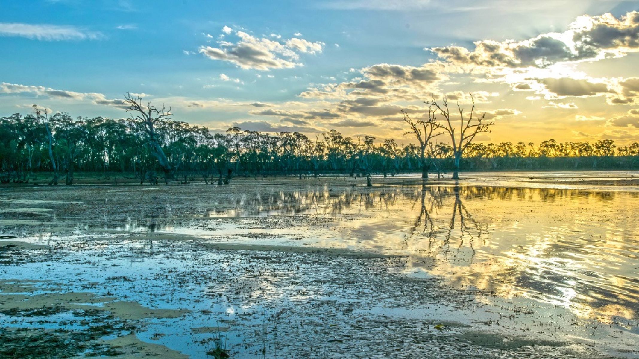
The Murray-Darling river system sustains rural towns, farms and communities. Many people rely on the basin for drinking water in Canberra, Adelaide and other regional cities. These communities also rely on the basin for thriving agricultural production.
It meets great cultural and spiritual needs for Traditional Owners and Aboriginal Victorians. For these people, water is deeply embedded into many traditions and spiritual practices.
Food production and tourism supported by the Murray-Darling Basin contributes billions to our economies. Abundant and diverse animal and plant life rely on this complex system to survive.
Why did we need a plan?
Healthy rivers and waterways contribute so much to our people, economies and environment.
Climate change, drought and other extreme weather events have decreased the amount of water naturally entering the river system. Humans are also changing the amount and location of water taken from the river.
A sustainable plan for water use was needed that protected the health of our rivers for future generations. Not only this, but to resolve competing interests in a fair and equitable way.
Map of Murray-Darling Basin
Key features of the Murray-Darling Basin Plan
Water resource plans
Water resource plans are a key tool for implementing the Basin Plan. The Basin Plan requires all Murray-Darling Basin states, including Victoria, to prepare water resource plans that set out how we will comply with the sustainable diversion limits. The plans improve consistency and transparency in water resource management across all Basin States and are accredited by the Murray-Darling Basin Authority.
Learn more about water resource plans, specifically Victoria's and refer to the Murray-Darling Basin Authority (MDBA).
Sustainable Diversion Limits
Sustainable Diversion Limits set limits on how much water can be taken from rivers for towns, industries and farmers in the Murray-Darling Basin while keeping rivers and the environment healthy. Across the Basin, each of the 29 river catchments and 80 groundwater areas has its own limit.
Sustainable Diversion Limit Adjustment Mechanism
The Sustainable Diversion Limit Adjustment Mechanism (SDLAM) is a way to change the 2,750 gigalitres (GL) target if we can achieve similar or even better environmental outcomes for the rivers, wetlands, birds and fish using less water.
It’s a provision written into the 2012 Basin Plan and agreed by Basin States and the Commonwealth. In 2017, 36 projects that offset 605 GL of water recovery were agreed upon.
Victoria is a proponent or co-proponent of 22 of the 36 notified projects. These include environmental works projects delivered through the Victorian Murray Floodplain Restoration Program (VMFRP), constraints projects, rule changes and The Living Murray program.
Water for the environment
In 2012, the Basin States and the Federal Government agreed that 2,750 GL of water from across the Basin would be delivered to the environment through the Basin Plan to improve the health of the Murray Darling Basin.
In 2018 the Federal Government allowed up to 605 GL to be deducted from the 2,750 GL total by investing in projects that deliver the same environmental outcomes using less water. 605 GL of projects have been approved. States are now working hard to develop further and deliver these projects.
In the early stages of the Plan, most of this water came from buying water shares from farmers. Now, most water for the environment comes by making water use more efficient.
The MDBA annually reports on the progress of the SDLAM projects across the Basin. Learn more about Victoria’s Sustainable Diversion Limit Adjustment Mechanism.
450 GL of additional water recovery might be achievable if there are no socio-economic impacts from doing so. A rigorous set of criteria was agreed upon in 2018 to ensure this.
Page last updated: 08/09/23